
CEDAR RAPIDS, Iowa (KCRG) –We started Saturday morning with flurries across Eastern Iowa, and more snow is expected Saturday night & into Sunday morning.
Saturday Travel Forecast
Travel shouldn’t be impacted on Saturday morning and Saturday afternoon in Eastern Iowa. Even though there were snow flurries in the region on Saturday morning the Iowa DOT reported seasonal roads. Partly covered roads were reported in Western Iowa. However, snow showers are expected to begin falling between 7 p.m. and 9 p.m. on Saturday evening. The snow will cause a few slick spots on roadways. Therefore, those who will be traveling this evening or overnight will need to be cautious.
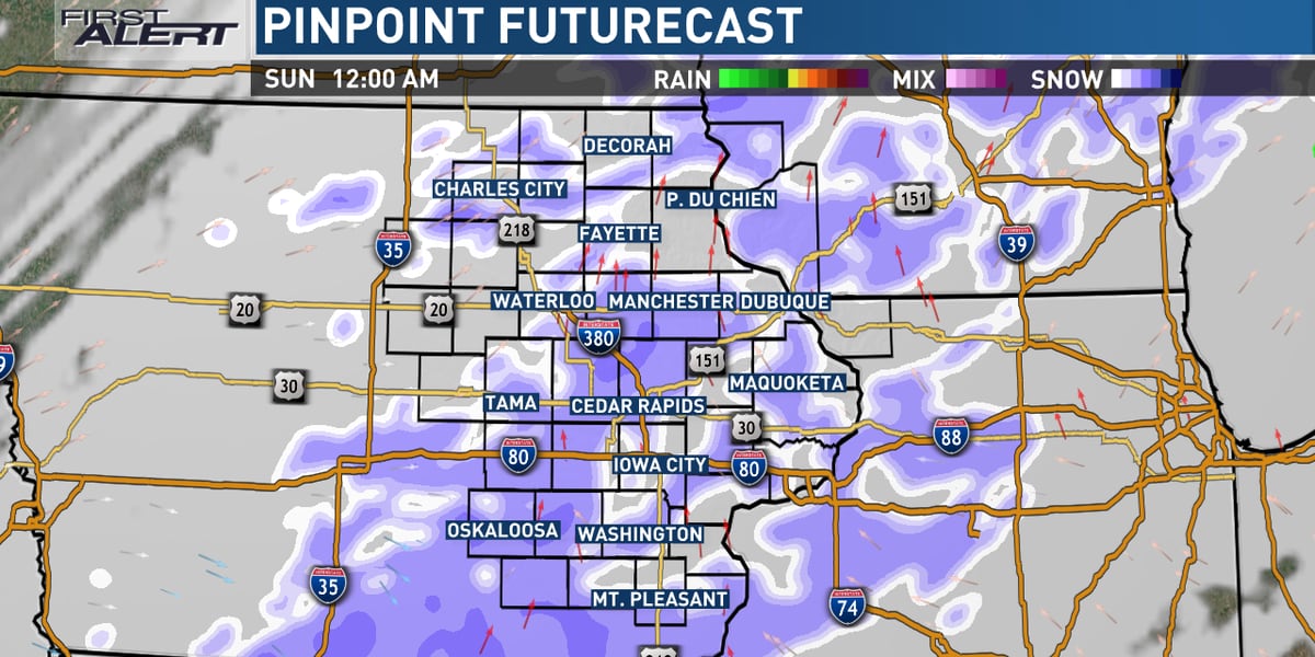
Sunday Travel Forecast
There will still be a few slick spots on the roadways on Sunday morning with lingering snow showers. the snow is forecasted to gradually come to an end by late Sunday morning. The snow is expected to stick with highs on Sunday only rising into the mid to upper 30s. A trace to 2 inches of snowfall will be possible across Eastern Iowa. Therefore, if you are planning to drive on Sunday, make sure to use safe winter driving practices by keeping plenty of distance between you and the car in front of you.
Copyright 2023 KCRG. All rights reserved.