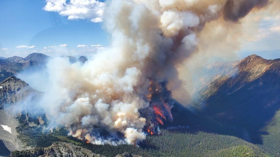
On a Friday night in early July, Nikki Skuce heard from a neighbour the news she had been dreading: her small community of Smithers, British Columbia was on an evacuation alert due to an encroaching fire that was only 4km (2.4 miles) away.
“My daughter quickly acted and packed a to-go bag and the rest of us followed suit,” says the 51-year-old director of a non-profit. “Then we tried to sleep but I was up most of the night.”
The next day she was constantly trying to get accurate information, while people nearby checked to see if the family was okay.
In the end, Ms Skuce and her family didn’t need to evacuate, but the acrid smoke from the wildfire irritated her lungs enough to force them inside their home, windows shut tight.

British Columbia is just one of many provinces in Canada enduring a scary season of raging wildfires.
Almost 900 forest fires were active in Canada during the week of July 17, burning a total of 10 million hectares and making it the worst fire season on record. Those wildfires also released more planet-warming carbon dioxide in the first six months of 2023 than in any full year on record.
This destruction has spurred investment in technology that might help detect wildfires before they become serious.
Based in Germany with a Vancouver office, OroraTech has eight satellites in low-earth orbit with special infrared sensors that monitor temperatures in grids of four-by-four meters.
Combined with data from other satellites, their system can quickly spot temperature anomalies and report them to clients, which include forestry and firefighting services.
The system can also analyse the data and forecast how fires might develop.
“Our software can tell you which fire out of the many on the ground will grow faster than others,” says Thomas Grübler, chief executive of OroraTech.
By 2026 their system should be able to scan the earth 48 times a day.
Another company, New York-based Cornea, harnesses AI to feed geographical and topographical data into its maps that can lay out potential fire behaviour, says chief executive Josh Mendelsohn.
“We want to optimize how we give those forest management personnel a clearer ability to communicate to communities what the wildfires risks are,” he says.
In a large wildfire outbreak, it’s not always possible to suppress every fire. So Cornea’s mapping system also identifies positions with a higher probability of success in battling a fire.

SensaioTech, based in Toronto and Brazil, has developed a device about the size of a smartphone, which can monitor 14 different variables on a forest floor, including soil temperature, humidity and salinity.
Those readings, taken every minute, are then shuttled to a dashboard for clients to review and can also alert mobile devices when those variables reach dangerous levels.
“The best satellite data is 30 minutes old,” says chief executive João Lopes, “but our sensors provide real-time data of what’s happening within a forest floor.”
Drones are also getting an upgrade to help firefighters. FireDrone, an experimental drone developed by scientists from Imperial College London and Switzerland’s Empa research institute, can withstand temperatures of up to 200C for as long as 10 minutes at a time.

Used more for battling fires than detecting them, the idea is that this drone can swoop into burning buildings on its own and then relay information to firefighters such as the distribution of fire sources and the location of trapped people.
Despite all the new tech, figuring out which forests will be the home for the next fire is a guessing game, says Michael Flannigan, BC Research Chair for Predictive Services, Emergency Management and Fire Science at Thompson Rivers University.
Sensors can find dry soil and high heat but they can’t often predict one of the main causes of wildfires: lightning, which Mr Flanigan says has caused four times more fires in the Western US since the 1970s.
“And let’s be honest, too, we’re living in a warmer world, so climate change is a factor we can’t ignore,” Prof Flannigan adds.
But of all the breakthrough technologies in the past half-century that have contributed to detecting wildfires, he points to a reasonably unassuming device.
“Cellphones have allowed the public to locate fires and alert fire management, and we’re seeing more fire agencies coming out with their own apps to make that easier for the public,” Prof Flannigan says.

More technology of business:
- Do you need a degree to work in tech?
- Lean times hit the vertical farming business
- The quest to grow the perfect strawberry
- How an autopilot could handle an emergency descent
- Can Amsterdam make the circular economy work?

Related Topics
- Artificial intelligence
- Wildfires
