BRYAN, Texas (KBTX) – After a winter-like start to the month, November flipped the script back to summer this week with highs in the upper 80s. Missing that fall-like feel? It is on its way, but it may make a bit of a mess as it arrives.
WHEN DOES THE FRONT ARRIVE?
Thursday will start similarly to the rest of this week with low temperatures in the upper 60s and feeling a touch muggy. All the while. our next cold front is slowly making its way through the state. Along and behind that front Thursday morning, showers will be widespread across west Texas. Don’t let that quiet start fool you. Make sure you pack the umbrella before you head out the door, as most of us will need it by the evening hours.
The cold front arrives to the northwestern corner of the Brazos Valley around lunchtime, works through Bryan-College Station between 3 and 5pm, and doesn’t clear into our southern counties until the later evening hours. While this will not bring a *sharp* drop in temperatures like our last front, still expect temperatures to fall about 10° within the first hour of the front moving past.
HOW MUCH RAIN CAN WE EXPECT?
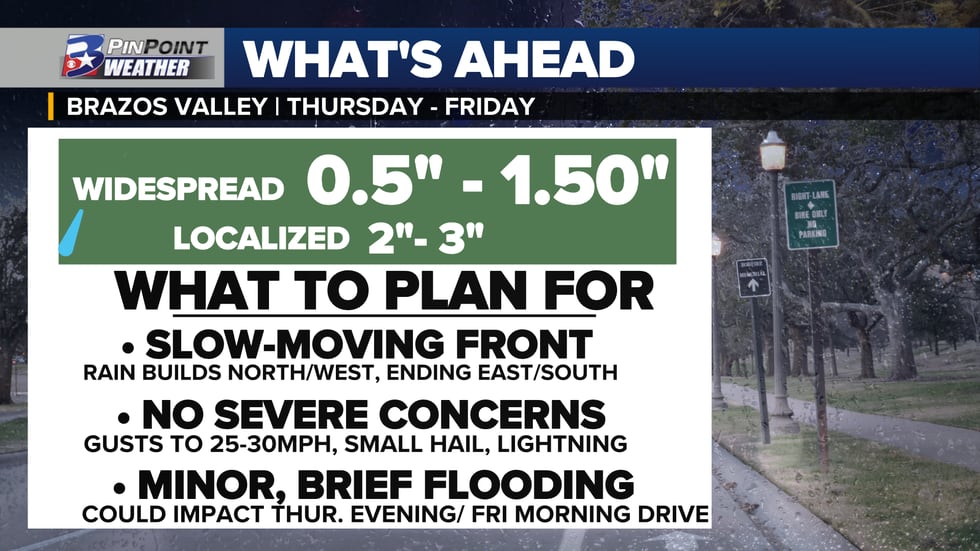
As for rain, we stay pretty much dry through the first half of the day. After lunchtime, scattered showers will start to pop up across the Brazos Valley and gradually increase in coverage through the afternoon. The evening commute home could be a bit of a mess, with coverage only increasing more through the evening and overnight. While this will not be constant, heavy rainfall, we can expect widespread light to moderate consistent rain as early as 9pm through the pre-sunrise hours of Friday. Friday morning may be one to set the alarm a touch early, as the rain looks to hang around through the morning commute before decreasing in coverage into the afternoon.
When all is said and done, widespread rain totals can be expected to land between 0.5″-1.5″ with localized totals closer to 2″-3″ possible where heavier pockets of rainfall, or where we see training occur. This much rain in not a whole lot of time could lead to some minor flooding concerns, ponding on roadways, and slick streets especially around the Thursday evening and Friday morning drive.

LIFE BEHIND THE FRONT
Friday will bring a much different day than what we started the week with. The cooler air behind the front paired with lingering clouds and rain in the morning will only bring us a high temperature in the mid-60s. In addition to that cooler feel, it will be a bit breezy! Winds will huff and puff at you out of the northeast 10-15 mph with gusts closer to 25mph. We will keep that fall-like feel all the way through the weekend and into early next week with morning lows in the mid and upper 50s and highs in the mid and upper 60s.
In terms of rainfall, the weekend looks to be mostly quiet. But if you have any Veteran’s Day plans, or just Saturday plans in general we’ll keep a 30% chance for a lingering shower. Not a washout of a day by any means, but certainly could be reaching for the rain gear even if only for a brief moment.
This forecast has a lot of moving parts, so make sure to keep tuned in on-air, online, and of course on the KBTX PinPoint Weather App!
Copyright 2023 KBTX. All rights reserved.
