SYRACUSE, N.Y. (WSYR-TV) – Will our holiday travel plans be impacted by the weather over the next few days? Find out all the details below…
Dry start to Tuesday with even some sun
After a dry start to the short work and school week Monday, we will be watching our next system approaching from the southwest on Tuesday. Some filtered sun will be with us to start the day, but clouds increase quickly late Tuesday morning and early afternoon.
Precipitation arrives Tuesday afternoon
Rain arrives Tuesday afternoon between about 1 and 3 pm around Syracuse, but the precipitation may very well start as a bit of snow and wintry mix, especially north and east of Syracuse. That said, most of the precipitation is expected to fall as just rain for the majority of CNY, including Syracuse. Highs on Tuesday will top out in the upper 30s to low 40s.
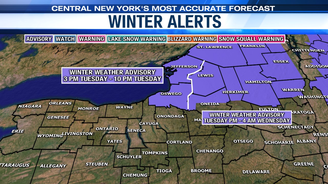
There is a Winter Weather Advisory in effect for areas northeast of Syracuse late Tuesday afternoon and Tuesday night as you can see below…

Any mix doesn’t last long
Temperatures will be in the mid to upper 30s for most to start Tuesday night but should warm well into the 40s for many late Tuesday night into early Wednesday. This will allow any areas of mixed precipitation to transition back over to all rain Tuesday night.

Who has the best chance of snow/ice accumulation?
Most areas, including Syracuse will not see any snow/ice accumulation, but towards the Tug Hill, Adirondacks and possibly hills southeast of Syracuse we do expect a slushy coating to an inch or two of snow and sleet and possibly a glazing of ice too late Tuesday afternoon and night.


Widespread rain tapers to a few lingering showers come Wednesday morning as drier and cooler air gradually works in during the day. Highs for the big travel day rise into the mid to upper 40s. This is great news for all the travelers in and around CNY!
For more on the holiday travel forecast, click here.
Keep checking the latest 7-day forecast for updates.