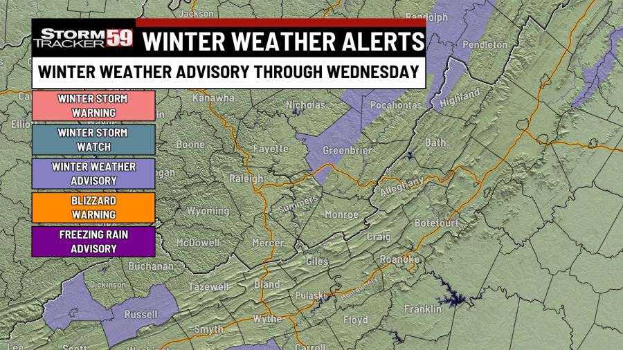
Watches/Advisories in Place for Our Region
- Winter Weather Advisory: Northwest Pocahontas County through 7 p.m. Wednesday and for western Greenbrier County through 10 p.m.

Tonight features rain showers switching to snow showers in the lowlands with occasional snow squalls, as a west wind switches to a northwest flow and allows for a feed off of the lakes to develop. It’s cold enough for snow throughout the night for the high mountain spots, such as Snowshoe but it’ll take some time for the transition to take place in the lowlands.

Though snowfall totals tonight into Wednesday will be quite minor for most, air temperatures will drop below freezing tonight, allowing for slick spots to develop, primarily over bridges and overpasses. Snow squalls will be capable of reducing visibility, briefly covering roadways with snow and breezy conditions. We’ll see temperatures fall back to around 30 degrees.

Wednesday begins on the snowy side! We’ll see bands of snow showers in the region with our lake effect setup continuing to kick strong early in the day. Though snowfall accumulations will again be mostly limited to the higher elevations due to warm ground temperatures, anyone under a stout snow squall could see a brief light accumulation of snow, reduced visibilities and slick conditions.

In addition, with air temperatures below freezing Wednesday morning, black ice will be a concern on untreated surfaces, especially bridges and overpasses. Plan to give yourself a couple of extra minutes heading out the door. In addition, we won’t see much of a temperature increase, with highs only in the low 30s.

Thursday sees our conditions improve, with plenty of sunshine ahead and high temperatures jumping back up into the 40s after a chilly start in the 20s.
Friday continues our warming trend. Mostly sunny skies and a southerly wind flow with an area of high pressure down to our southeast will enable temperatures to jump back up into the mid 50s, which is a few degrees above normal for this time of year.

Saturday is shaping up to be our warmest day in quite some time! A stout southerly breeze out ahead of our next storm system should allow temperatures to jump into the low 60s – that’s about 15 degrees warmer than our average for this time of year. Expect a bit of a breeze, with wind gusts up to 25 mph possible but at least we’re dry!
Sunday brings our next chance of rain back into the region, with a cold front scooting through. There is still some fine-tuning needed on the exact timing of this system, but expect showers and gusty conditions with highs in the 50s. This system will bring some much cooler air back into the region for Monday. Wind gusts could exceed 30 mph on Sunday as our stout cold front crosses – perhaps even a thunderstorm or two will be possible!

Monday looks cold with perhaps a sprinkle or two in the morning. High temperatures will only make it into the 30s despite sunshine returning in the afternoon as a result of a cold westerly breeze in place.
Tuesday sees a slow improvement in temperature forthcoming, with high temperatures in the low 40s after morning temperatures in the 20s.

In your extended forecast, although bouts of cold weather will briefly ooze their way into our region from Canada, the overall outlook is warm. In addition to warm conditions, our pattern is trending a bit more unsettled, with a series of systems working their way through. Don’t forget that you can download the StormTracker 59 app, free on the Apple and Google Play stores – you can check the radar and zoom in on your neighborhood with just a couple taps of a button!

TONIGHT
Rain switches to snow. Watch for black ice! Lows around 30.
WEDNESDAY
Snow showers likely early, some slick travel. Cold. Highs near freezing.
THURSDAY
Mostly sunny. Warmer. Highs in the mid 40s.
FRIDAY
Mostly sunny. Much warmer. Highs in the mid 50s.
SATURDAY
Partly sunny. Very warm! Highs in the low 60s.
SUNDAY
Few showers likely. Breezy. Highs in the mid 50s.
MONDAY
Partly sunny. Much colder. Highs in the mid 30s.
TUESDAY
Partly sunny. Still cool. Highs in the low 40s.
WEDNESDAY
Mostly sunny. Highs in the 40s.
THURSDAY
Mostly sunny. Highs in the 50s.
FRIDAY
Mostly sunny. Highs in the 40s.