It only takes one storm in the wrong place at the wrong time to unleash chaos. That was what the population of Florida learned last year, when a near-normal hurricane season triggered one of the most deadly tropical cyclones in US history. Combined with the damage Hurricane Fiona wreaked on Puerto Rico, it also contributed to the third-costliest season on record.
Forecasting such disasters is not easy. How strong a tropical storm grows and where it hits are determined by weather patterns that are highly unpredictable beyond a few days. But scientists are at least able to give a broad overview of how each hurricane season will pan out. By tracking the development of various linked oceanic and atmospheric patterns, researchers can make predictions based on what they have learned from decades of data.
Earlier this month, scientists at the US National Oceanic and Atmospheric Administration (NOAA) updated their predictions for Atlantic hurricane activity in 2023 – warning that it is now likely to be an above-normal season with more storms and major hurricanes than seen in an average year. Record ocean temperatures and unusual wind patterns in the atmosphere are contributing to a complex push-and-pull effect that governs the emergence of hurricanes.
Researchers have also recently drawn attention to an under-studied phenomenon that may represent another key factor in determining a hurricane season’s outlook. A vast patch of water stretching out from the west coast of equatorial Africa undergoes periodic temperature fluctuations known as Atlantic Niño, or “El Niño’s little brother”. New research suggests this cycle of changing Atlantic Ocean sea surface temperatures can fuel some of the most powerful hurricanes that strike the Caribbean and US.
There are many factors, however, that determine whether a hurricane forms, how powerful it becomes, how long it lasts and where it makes landfall. And the Atlantic Niño’s bigger sibling in the Pacific will play a major role in determining what happens in this year’s hurricane season.
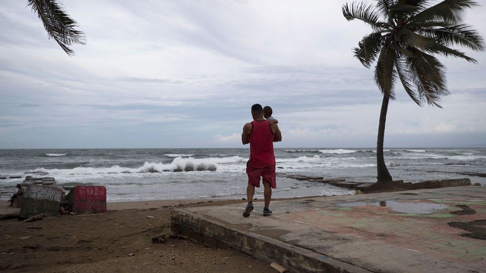
Often it is not the number and intensity of storms that predicts how much damage a hurricane will do, but rather when and where it makes landfall (Credit: Getty Images)
The El Niño effect
Of the many climate systems that shape the birth of tropical storms in the Atlantic Ocean, two have typically stood out.
The El Niño Southern Oscillation (ENSO) is a global climate pattern that forms in the Pacific and fluctuates between the warming phase of El Niño and the cooling phase of La Niña. During an El Niño, warmer-than-average Pacific ocean temperatures drive global atmospheric circulations and increase vertical wind shear in the Atlantic. Hurricane systems like to stay upright, so when wind shear (the difference between the speed and direction of winds blowing at various altitudes) is high, they are at risk of toppling over and being pulled apart. By contrast, El Niño also leads to an increased risk of tropical cyclones in the northeast Pacific. The arrival of Tropical Storm Hilary on the west coast of Mexico and Southern California – the first in the state since 1939 – has been attributed to the current phase of the climate pattern.
Back in the Atlantic, the second major determinant of hurricanes is the Atlantic Meridional Mode (AMM), which represents fluctuations in low-level winds and tropical sea surface temperatures in the ocean. So when AMM is in a positive mode, ocean temperatures will be warmer than usual and offer up more heat, which fuel storms passing above.
The other Niño
Both the ENSO and the AMM involve the interaction of ocean and atmospheric circulations – and measuring their impact on sea surface temperature helps predict hurricane activity, says Hosmay Lopez, an oceanographer at the NOAA. But both climate systems also have different locations where they’re dominant. AMM has a strong impact on storm formation in the middle of the tropical Atlantic basin. Meanwhile, the ENSO usually has its largest influence over hurricanes that form in the Caribbean and the Gulf of Mexico.
In contrast, the climate pattern known as Atlantic Niño can be highly influential on storms that form off the coast of West Africa. This third potential predictor of hurricane activity involves similar dynamics to the ENSO. Yet since it takes place in the smaller Atlantic ocean, its global impacts are less pronounced than its bigger Pacific brother, and its effect on Atlantic hurricanes has been less widely studied – until now.
“We’ve known of Atlantic Niño’s existence for many years,” says Lopez, who was part of the team that uncovered its role in hurricane development. “It’s only recently there’s been more scientific curiosity.” Not least because it’s been seen that it does influence some globally important climates, such as rainfall in the Sahel and the North African Monsoon.
It was already known that many of the most destructive hurricanes have an unlikely birthplace – in atmospheric disturbances above the Sahara Desert and the Sahel. These can generate storms that spin out over the Atlantic Ocean close to the Cape (Cabo) Verde archipelago off the coast of West Africa. Here they can feed off the warm tropical waters until they become hurricanes – and the warmer the ocean is, the more energy hurricanes can gather.
And this is where Atlantic Niño may play a role.
Tropical storms which form in the Gulf of Mexico are closely hemmed in by the surrounding land, meaning they have a high chance of making landfall but less time to pick up the energy they need to grow into high-force hurricanes. But the so-called Cape Verde hurricanes have had a long time to travel over the ocean and suck up its heat. As a result, Cape Verde hurricanes account for 80-85% of all major hurricanes to strike the US and Caribbean.
Atlantic Niño may therefore have an outsized influence on a hurricane season’s destructive potential, since they fuel some of the Atlantic Oceans’ most intense storms.
El Niño’s climate pattern is still the most dominant in terms of global climate impact, says Lopez, “but all [three] bring something to table in terms of improving the system of hurricane outlooks”.
“We can’t say one is more important, because then we stop learning new things,” he adds.
You might also like:
- The surprising place where the most powerful hurricanes are born
- There’s a heatwave in the sea and scientists are worried
- The weird winds that supercharge heatwaves and wildfires
‘Clash of the titans’
So what does the newly-understood influence of Atlantic Niño mean for current hurricane predictions? This year, not much. The Atlantic Niño is currently in what is known as a “neutral phase” – meaning it is in the transition between the cold and warm fluctuations. “It is unclear at this point if the Atlantic Niño condition will develop this year,” says Dongmin Kim, another of the NOAA scientists involved in the research.
That means scientists are focusing on the signals provided by ESNO and AMM, which this year are pulling against each other in an ocean-scale tug of war.
Most forecasts in March-April predicted a near or below average hurricane season, since the dampening effect of El Niño’s wind shear was expected to be significant, says Phil Klotzbach, an atmospheric scientist at Colorado State University. But although El Niño is developing quickly, it takes a while to build up and meanwhile sea surface temperatures in the Atlantic are at a record high. This has now put the chances of an “above normal” hurricane season at around 60%, according to NOAA’s August forecast.
“I characterise this as a clash of the titans,” says Klotzbach. “If we had a La Niña too, we’d be heading for a gangbusters crazy season, but because these factors are pulling against each other, we’re going for a moderate one.”
Climate change is also leaving its imprint on hurricane formation. Research predicts that while Atlantic Niños could weaken in response to global warming, global human-made atmospheric heating has also helped load the dice in favour of more intense hurricanes.
")
Hurricane Ian, which tore across Florida in October 2022, was one of the most powerful storms to ever hit the US (Credit: Getty Images)
More research is needed to fully understand such heating’s impact on the planet’s climate patterns. And improved satellite data is helping here. As are multinational projects like the Prediction and Research Moored Array in the Tropical Atlantic (Pirata) – an array of moored buoys which observe ocean-atmospheric variability in the tropical Atlantic.
This year, however, those who live in areas most commonly hit by hurricanes are being warned to brace themselves for an overactive season. With more storms forecast, so too are the chances of them making landfall. Researchers at Colorado State University have estimated the probability that a major hurricane will make landfall somewhere along the US coastline to be around 48% – a slight increase on the long-term average of 43%.
“If you throw 300 darts at a dartboard, chances are you’re going to hit a bullseye,” says Klotzbach.
The message from the forecasters at the NOAA is to get prepared.
—
Join one million Future fans by liking us on Facebook, or follow us on Twitter or Instagram.
If you liked this story, sign up for the weekly bbc.com features newsletter, called “The Essential List” – a handpicked selection of stories from BBC Future, Culture, Worklife, Travel and Reel delivered to your inbox every Friday.